


€ 1.239,00 (vat incl.)
€ 1.007,32 (vat not incl.)
Manufacturer: Raymarine
Part Number: E70720
Our Ref.: 120686
The Axiom2 7” is a 7” multifunction display from Raymarine that offers faster performance and enhanced processing power.
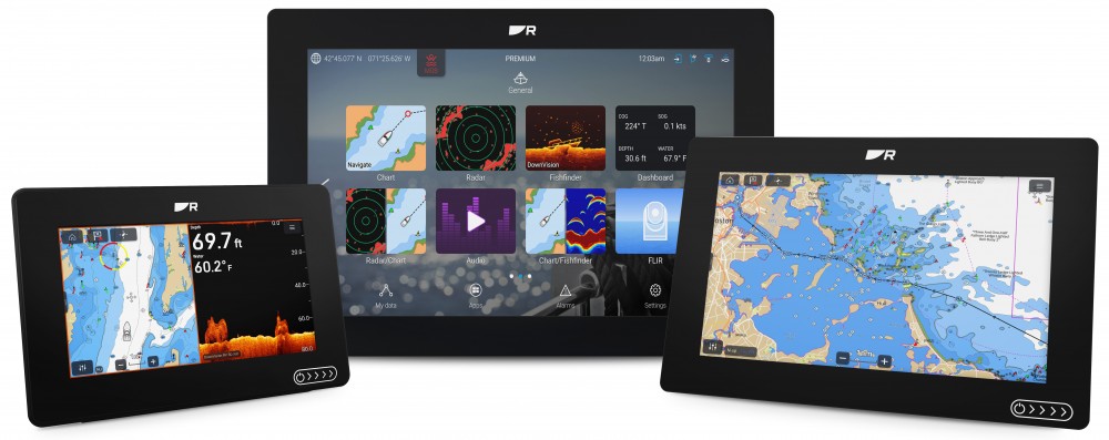
Axiom 2 chartplotters deliver faster performance and upgraded processing power in 7-, 9-, or 12‑inch sizes. Available as chartplotter‑only or with built‑in RealVision™ sonar.
The Marine Chartplotter You Trust. Now Even Better
Our most popular marine chartplotters — now faster, more connected and built for the future. Axiom 2 unifies navigation, sonar, radar, video and NMEA 2000 networks into one powerful display. Choose Axiom 2 as a dedicated chartplotter for confident navigation, or step up to Axiom 2 RV for the ultimate all in one chartplotter and fish finder combo.
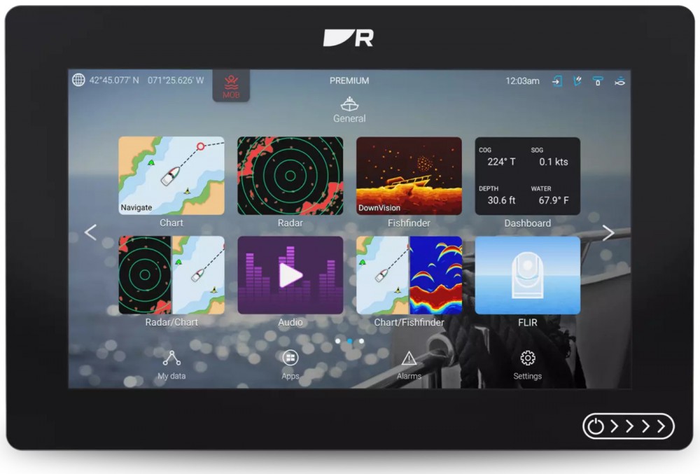
One Display. Total Control
Axiom 2's LightHouse operating system is a single, simple-to-use interface for complete situational awareness. Make Axiom 2 your all-in-one multifunction display or connect additional Axiom 2 displays at your helm or a remote station.
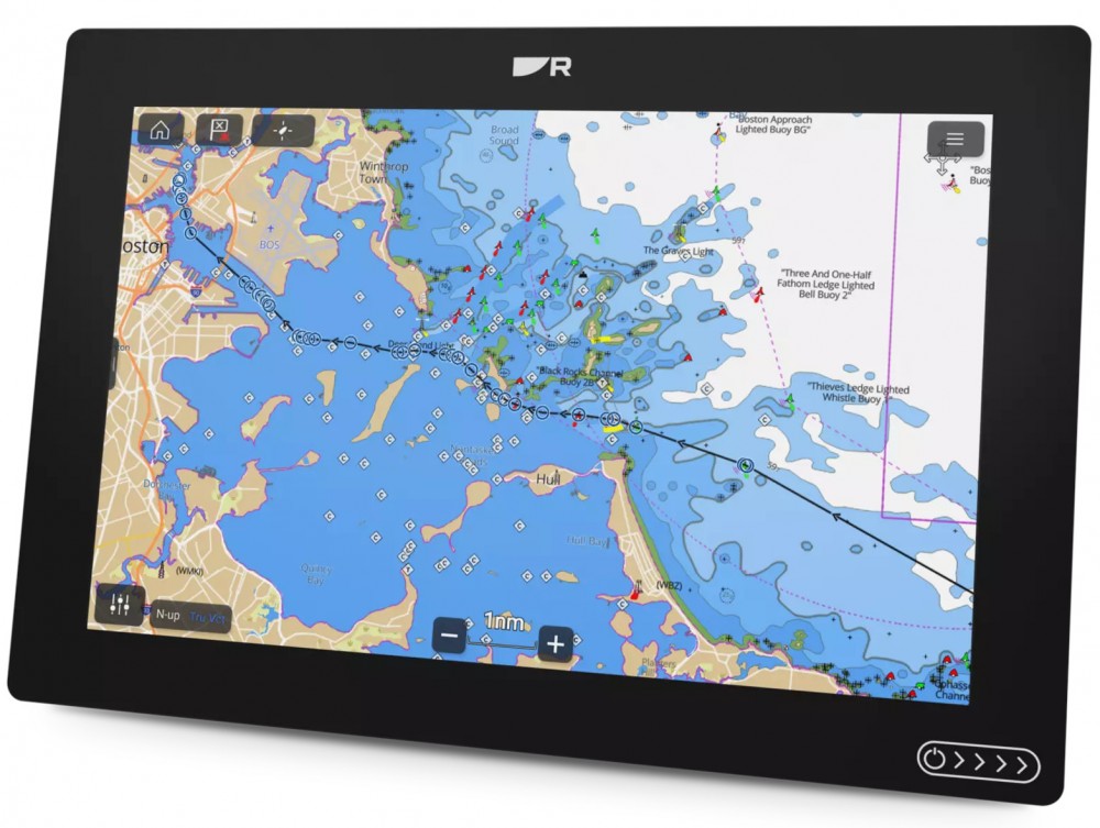
Navigate Smarter with LightHouse Charts GEN 2
Up to 30% faster chart rendering with a new 6 core processor and LightHouse OS. Choose Axiom 2 bundled with LightHouse Charts GEN 2 for smoother panning, faster redraws and expanded coverage.
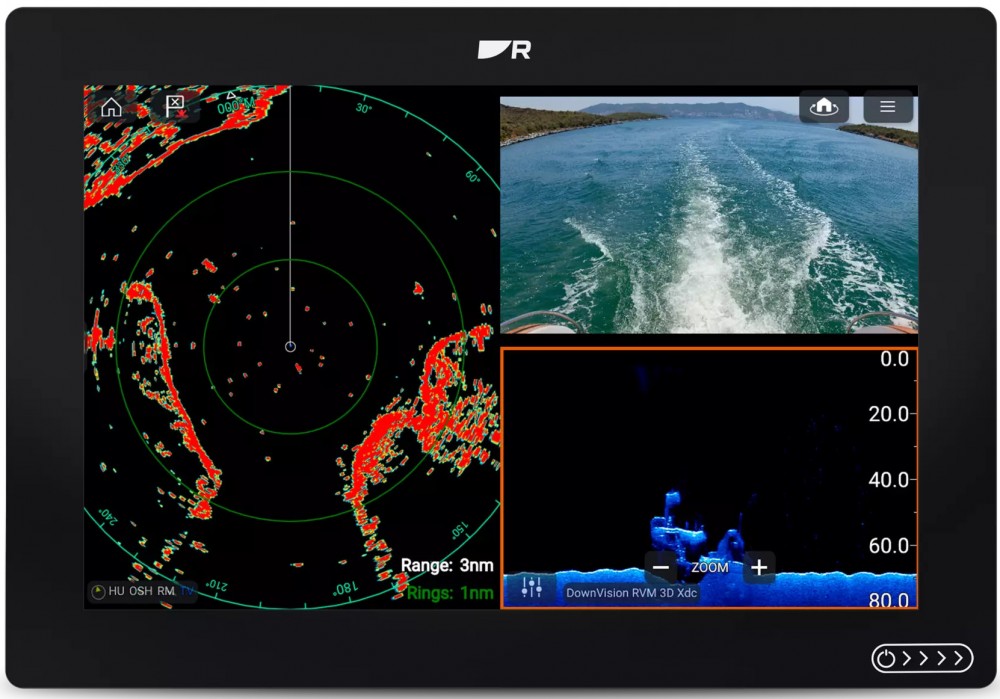
Built for Speed and Expansion
Gigabit RayNet Ethernet enables faster networking between displays and sensors. Experience smoother radar, sonar and video performance across the system.
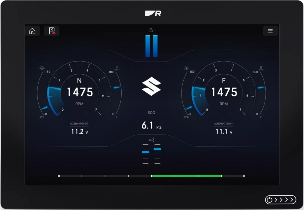
Engine Monitoring
Connect with leading engines including Mercury, Yamaha Suzuki and more. Monitor performance, fuel, and propulsion data directly from the helm.
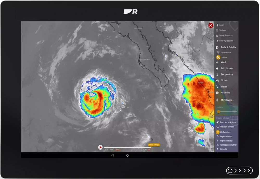
More capability, built in
Expand your Axiom 2 with access to 30+ marine apps. Take control of lighting, audio, energy monitoring and weather systems. Or stream entertainment from Netflix, YouTube and Spotify.
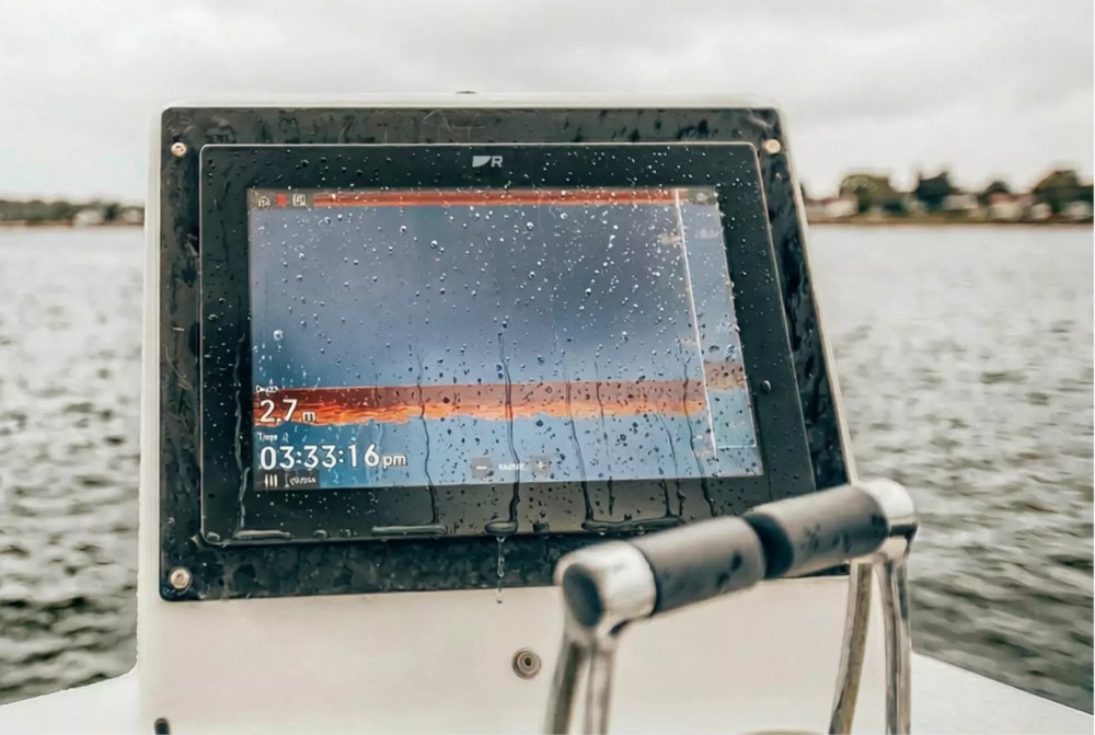
All-Weather Performance
Rugged IPX6 waterproof construction and bright HydroTough™ displays repel water for reliable touchscreen control in all conditions.
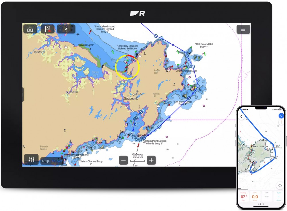
Plan Routes with the Orca App
Share a route from the Orca mobile app to Axiom 2 via Wi-Fi. Simply identify your starting point, your destination, and Orca’s advanced navigational algorithms will find the best route for your vessel.
Advanced Sailing Tools
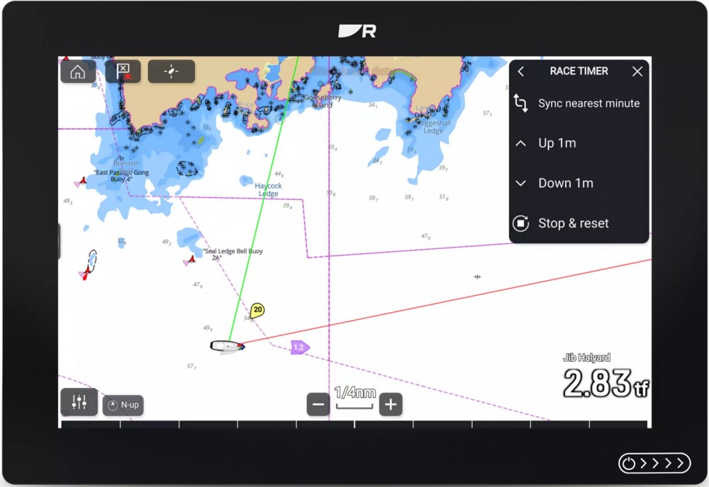
Optimize your performance under sail with Axiom 2's suite of powerful sailing features including polar profiles, dynamic laylines, race timers and tactical sailing displays.
SPECIFICATIONS
ENVIRONMENTAL
POWER
LCD
GPS
CHARTPLOTTER
Update your browser to view this website correctly. Update my browser now


